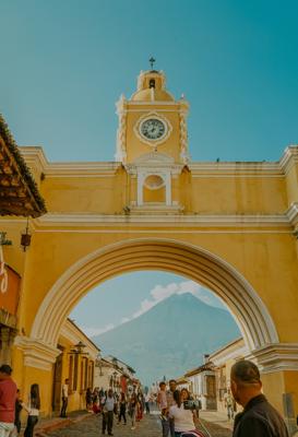
Guatemala, features and locations
Guatemala, features and locations
Regular price
$50.00
Regular price
Sale price
$50.00
Unit price
per
Couldn't load pickup availability
Guatemala, features and locations
a spatial dataset containing the locations (lat,long) of various geographical features for Guatemala. samples for this dataset are available here, csv json. (hint: right-click 'save link as')
about the data| row count | 36,271 |
|---|---|
| CSV delimiter | comma |
| CSV quoted by | double quote |
| numeric non-values | -9999.0 |
| text non-values | no-value |
| name | country | country code | continent | latitude | longitude |
|---|---|---|---|---|---|
| Barra de Tilapa | Guatemala | GT | North America | 14.49694 | -92.18111 |
| Centro Genova | Guatemala | GT | North America | 14.62505 | -91.83003 |
| Cerro Calderas | Guatemala | GT | North America | 14.43326 | -89.83511 |
| Finca Bramadero | Guatemala | GT | North America | 16.21742 | -89.99597 |
| Finca Emaus | Guatemala | GT | North America | 16.53729 | -89.76155 |
| Finca Santa Cristina | Guatemala | GT | North America | 14.56057 | -91.42495 |
| Mojanes | Guatemala | GT | North America | 15.17704 | -89.31183 |
| Rubelja | Guatemala | GT | North America | 15.6308 | -89.99175 |
| Sitio Arqueologico Perdido | Guatemala | GT | North America | 17.04756 | -89.37661 |
| Tzanjuyub | Guatemala | GT | North America | 14.76055 | -91.42896 |
| Vega Arriba | Guatemala | GT | North America | 14.76254 | -89.5605 |
| Yolsinis | Guatemala | GT | North America | 15.85295 | -91.53054 |
| field name | data type | minimum length | maximum length | unique value count | example values |
|---|---|---|---|---|---|
| latitude | float | 4 | 8 | 31809 | 13.98778 14.63074 14.66157 14.68367 14.99513 |
| longitude | float | 5 | 9 | 32679 | -91.37136 -90.5582 -89.89951 -89.54159 -89.35901 |
| country_code | string | 2 | 2 | 1 | GT |
| timezone | string | 14 | 19 | 4 | America/Belize America/El_Salvador America/Guatemala America/Mexico_City |
| featureName | string | 3 | 46 | 152 | historical site nature reserve road bend shrine |
| featureDescription | string | 8 | 187 | 139 | a flat-topped isolat... a funnel-shaped stre... a meandering channel... a paved urban thorou... a place where helico... |
| name | string | 2 | 65 | 24772 | Campamento Petrolero... Nazareno Semavac Shutimita Yerbabuena Baja |
| elevation | float | 3 | 7 | 3207 | 11.0 534.0 584.0 1002.0 1363.0 |
| country | string | 9 | 9 | 1 | Guatemala |
| continent | string | 13 | 13 | 1 | North America |
All fields have been cleaned, commas and non-ascii characters have been removed. all numeric fields are numbers where a "non-value" numbers have been replaced with -9999.0, text fields without a value have been give the value "no-value". there are non empty values in this dataset
license: Attribution 4.0 International (CC BY 4.0)
Images sourced from Unsplashed
View full details


